
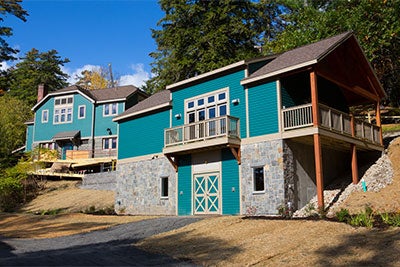
Rensselaer Darrin Fresh Water Institute
Base camp is at the Margaret A. and David M. Darrin ’40 Darrin Fresh Water Institute (DFWI), a multidisciplinary environmental research center on the shores of Lake George. At DFWI researchers gather to discuss discoveries and prepare for fieldwork. From DFWI, researchers also launch expeditions to survey the lake, gather samples, and deploy and maintain the network of sensors distributed around the lake.
Data Visualization
A key research facility at DFWI is the Helen-Jo and John E. Kelly III ’78 Data Visualization Laboratory – a 2,000 square-foot lab featuring advanced scientific computing and graphics systems. Within the lab, a high resolution display wall allows researchers to view data streaming in from the network of sensors distributed around the lake, as well as several computer models that depict natural functions of the lake.
Offshore Chemical Monitoring
For more than 40 years, DFWI has maintained the Offshore Chemical Monitoring Program. Begun in 1980 and jointly funded by RPI and The Lake George Association, the monitoring program was designed to assess water quality in order to help address concerns related to nutrient loading. Sampling focuses on essential nutrients for aquatic plants (phosphorus, nitrogen and silican compounds), as well as major cations, common anions, oxygen, chlorophyll, and temperature. The program represents one of the longest and most consistent sets of lake chemistry data in North America, providing a valuable benchmark for long-term change in temperate lakes worldwide.
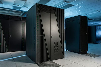
IBM Research
IBM Researchers in labs worldwide, including locations in New York, Brazil, and Ireland are developing the computational modeling and cyber-physical infrastructure being used in the Jefferson Project. Teams of IBM Researchers are developing four predictive models that precisely measure weather events, water run-off from the surrounding mountains into the lake, inputs of road salt to the lake, and water circulation. The models communicate with a network of sensors on Lake George collecting data on the Lake’s ecosystem. These efforts are creating a platform for observing events unfolding on the lake, and to predict the outcome of experimental scenarios.
Weather Model
IBM’s Deep Thunder high-resolution weather forecasting technology currently calculates 48-hour forecasts twice a day for the Lake George area, with one-kilometer resolution. One application of the weather model ties precipitation and snow pack data to runoff and circulation models to show how road salt is transported by runoff and its movement through the lake.
Runoff Model
Using data from the Deep Thunder weather model, terrain (topography), and soil characteristics, the runoff model shows how water from precipitation (rain, snowmelt) moves through the 233 square mile Lake George watershed.
Salt Model
Using the runoff model and a map of the roads in the watershed to determine road salt usage, the model is being designed to estimate the road salt inputs into the tributaries that supply water to Lake George.
Circulation Model
IBM's Deep Current model tracks the circulation of water throughout the lake including how particles/compounds enter the lake and how they travel within the lake.
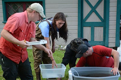
Rensselaer Aquatic Lab
Located on the RPI campus in Troy, NY, the Rensselaer Aquatic Lab is designed to conduct large-scale aquatic experiments. These experiments help identify the underlying causes of lake changes that are observed in our ongoing monitoring efforts. Whereas monitoring can tell us how the lake is changing, experiments can tell us why it is changing. An indoor lab allows researchers to conduct experiments under environmentally controlled conditions. An outdoor facility contains hundreds of mesocosms, tanks of water in which researchers are able to represent natural environments, like Lake George, and conduct experiments. Researchers use the mesocosm to simulate a wide variety of human impacts, including excess nutrients, road salt, and multiple invasive species.
Food Web Model
Rensselaer researchers are currently quantifying the abundance and distribution of the major players in the food web and conducting experiments that determine how these species interact, as a prelude to a food web model. The food web model is critical to understanding how changes in environmental conditions may have cascading effects on the ecosystem of Lake George.